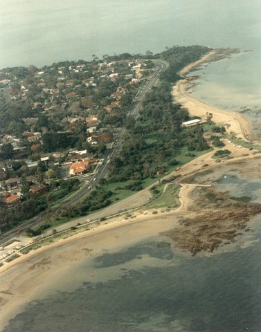
c.1980s Beach Road, Beaumaris
ID: 19686
Creator: Sandringham City Council
Copyright: library owns image (image on public access)
Org ID: 1aerial7
Description: Colour photograph, 25 x 20cm. This aerial photograph shows Beach Road curving up to Table Rock Point with Beaumaris Bay and Watkins Bay. Ricketts Point is seen with the north portion of the Ricketts point foreshore clearly in view.
Subject: aerial views
Please Contact:
Bayside Library Service
Image held by Bayside Library Service
14 Wilson Street, Brighton, Victoria
Australia 3186
ph: 03 9591-5900
email: baysidelibrary@bayside.vic.gov.au
web: www.bayside.vic.gov.au/library
|