c.1980s Beach Road - Table Rock - Beaumaris
ID: 19687
Creator: Sandringham City Council
Copyright: library owns image (image on public access)
Org ID: 1aerial8
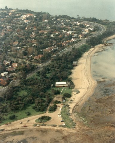
Description: Colour photograph, 25 x 20cm. This aerial photograph shows Beach Road curving up to Table Rock Point with Beaumaris Bay beyond. Watkins Bay is to the right, with Ricketts Point bottom left.
Subject: aerial views
Please Contact:
Bayside Library Service
Image held by Bayside Library Service
14 Wilson Street, Brighton, Victoria
Australia 3186
ph: 03 9591-5900
email: baysidelibrary@bayside.vic.gov.au
web: www.bayside.vic.gov.au/library
|