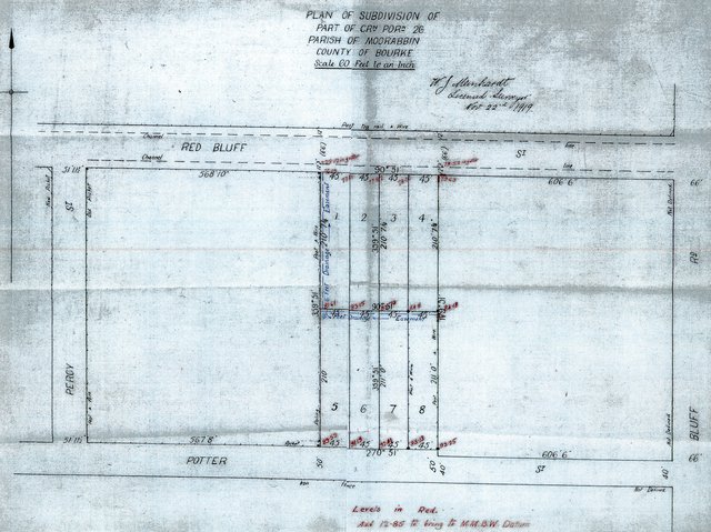
22/11/1919 Plan of subdivision of part of Crown Portion 26 Parish of Moorabbin, County of Bourke
ID: 20170
Copyright: library owns image (image on public access)
Org ID: 2land19
Description: Plan, 35 x 84cm. Handdrawn, 8 lots in black, with blue writing for feet drainage and easement. Red writing indicates levels. W.J. Meinhardt, licensed surveyor, November 22nd 1919. Frontages onto Red Bluff Street and Potter Street, between Bluff Road and Percy Street.
Subject: subdivisions
Please Contact:
Bayside Library Service
Image held by Bayside Library Service
14 Wilson Street, Brighton, Victoria
Australia 3186
ph: 03 9591-5900
email: baysidelibrary@bayside.vic.gov.au
web: www.bayside.vic.gov.au/library
|