c.March 1979 Nepean Highway - Widening - Brighton
ID: 19597
Creator: Sandringham City Council
Copyright: library owns image (image on public access)
Org ID: 3aerial1
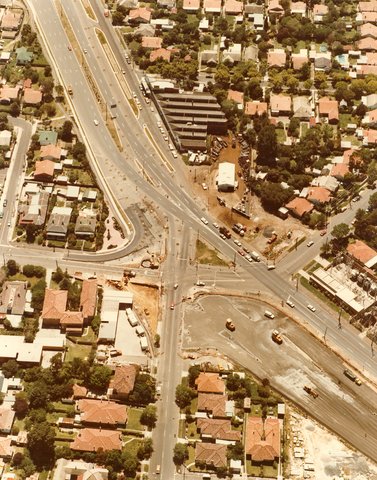
Description: Colour photograph 20 x 25cm. This photograph shows Nepean Highway in the process of being widened. It is an aerial photograph showing the intersection of Bay Street, Hampton Street, Milroy Street and Nepean Highway. Formerly Nepean Highway was called The Great Western Port Road, then Point Nepean Road, then Nepean Highway.
Subject: aerial views
Please Contact:
Bayside Library Service
Image held by Bayside Library Service
14 Wilson Street, Brighton, Victoria
Australia 3186
ph: 03 9591-5900
email: baysidelibrary@bayside.vic.gov.au
web: www.bayside.vic.gov.au/library
|