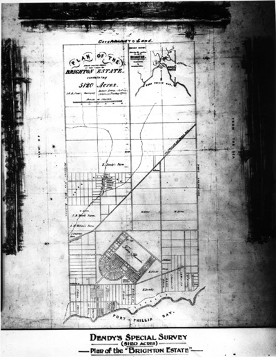
18/10/1841 Dendy's special survey
ID: 7084
Creator: Baker's Lithograph(Sydney)
Copyright: library owns image (image on public access)
Org ID: 255791
Description: 2 B&W + 2 Sepia photographs of the original map created by N.B. Foot Surveyor. Foot would have had a stone block of the map done for publication. Henry Dendy's special survey was 5120 acres and called the Brighton estate. The 2 B&W copies show added sketches of Brighton c1841, eg. early coastline and cottages.
Subject: measured drawings
Please Contact:
Bayside Library Service
Image held by Bayside Library Service
14 Wilson Street, Brighton, Victoria
Australia 3186
ph: 03 9591-5900
email: baysidelibrary@bayside.vic.gov.au
web: www.bayside.vic.gov.au/library
|