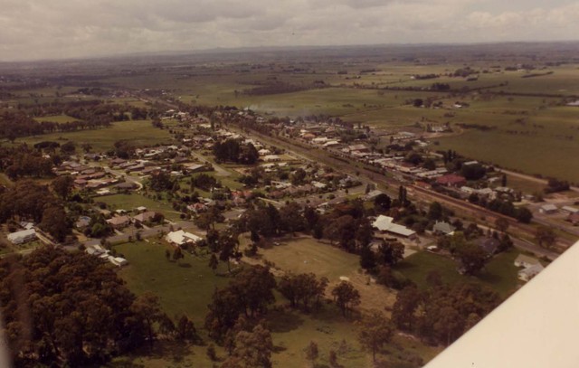
November 1985 Garfield aerial photograph
ID: 21574
Creator: Shire of Pakenham
Copyright: library owns image (image on public access)
Org ID: Series 59.1
Description: Aerial of Garfield. The road that comes in from the centre left is Garfield Road, which runs out to the Princes Highway. It intersects with the Gippsland railway line; the south side of the railway line is Nar Nar Goon-Longwarry Road.
Subject: aerial photographs
Please Contact:
Casey -Cardinia Library Corporation
Image held by Casey-Cardinia Local History Archive. For further information please contact the Local History Librarian at Narre Warren Library telephone (03) 9704 7696.
Postal address is Locked Bag 2400 Cranbourne 3977
www.cclc.vic.gov.au
|