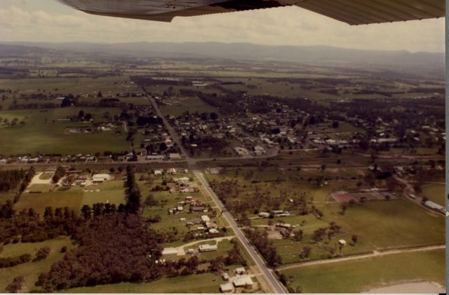
November 1985 Bunyip aerial photograph
ID: 21582
Creator: Shire of Pakenham
Copyright: library owns image (image on public access)
Org ID: Series 59.2
Description: Bunyip, looking north. The intersection is of Bunyip-Modella Road with the Nar Nar Goon-Longwarry Road and the railway line. Bunyip-Modella Road becomes Hope Street, north of the railway line.
Subject: aerial photographs
Please Contact:
Casey -Cardinia Library Corporation
Image held by Casey-Cardinia Local History Archive. For further information please contact the Local History Librarian at Narre Warren Library telephone (03) 9704 7696.
Postal address is Locked Bag 2400 Cranbourne 3977
www.cclc.vic.gov.au
|